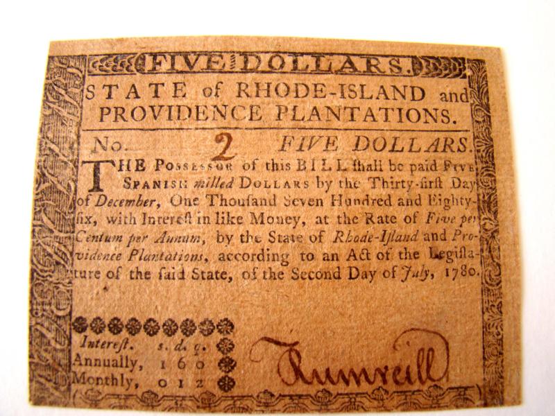
CLICK TO ENLARGE
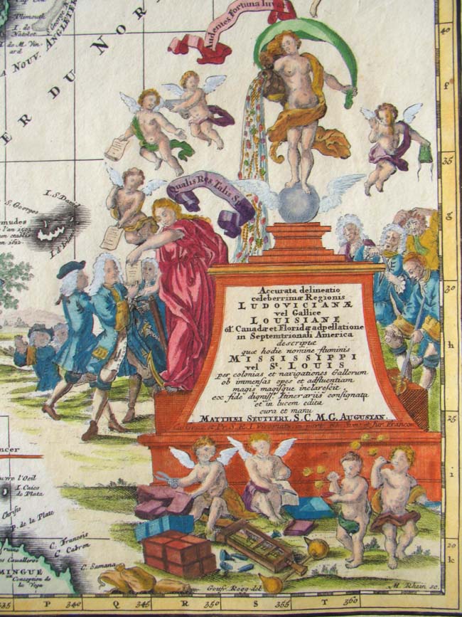

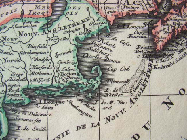
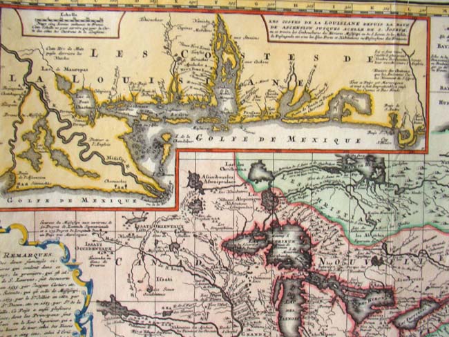

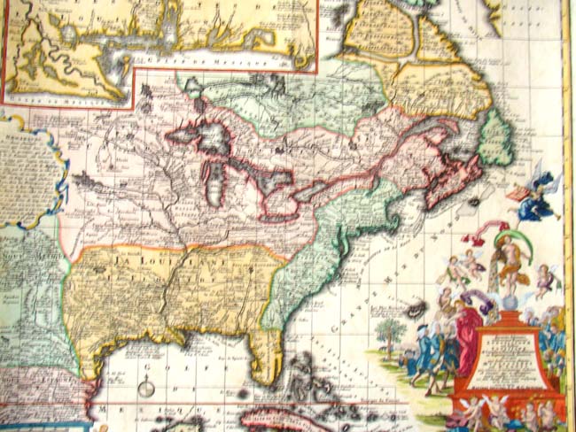
This extremely decorative and historic map shows in detail much of North America focusing on the Mississippi River and the Great Lakes. A large inset of the gulf Coast shows many forts and Indian villages. The Mississippi Company was formed in 1716 as a means to dig France out of an economic and financial recession. It was designed by the famous Scottish financier John Law (1671-1729). The rise and eventual collapse of the Mississippi Company became known as the Mississippi Bubble and this map was created for its investors. The map has been custom framed and matted and also has UV protected glass. The frame measures 28 1/2" by 25 1/2."